Leaving Maine, we headed to the White Mountains of New Hampshire. Quite a few waterfalls and once again, great hiking. One of the places we wanted to visit was Crawford Notch State Park. Gary has a picture from when his family visited there more than 60 years ago.
The Bogart Family visiting the park in the mid 50’sThe Bogart family visiting the park in 2018!
Hiked to the top of Mt Willard and sat atop the granite peak. You can see the road in the picture.
On top of the granite wall of Mt WillardMt Willard from the road – Can you see me?
Typical morning breakfast, I’m sure I am having my 2nd latte. Gary usually serves me my first latte in bed! Who wouldn’t want to continue this?Just finishing up breakfast – probably 10 am- getting energy for a morning bike ride!A typical campsite
We so enjoy the Provincial Parks in Canada but are glad to be back in the USA – at least for a while.
One of our last sunsets in New Brunswick, CanadaLittle cool down for Jake and Judy along the Canadian Coast.
We returned to the US via the border in Calis, Maine, it was much easier leaving Canada than entering it- Canadian Border Patrol searched the entire RV and it took us over an hour, entering the USA it took us maybe 10 minutes.
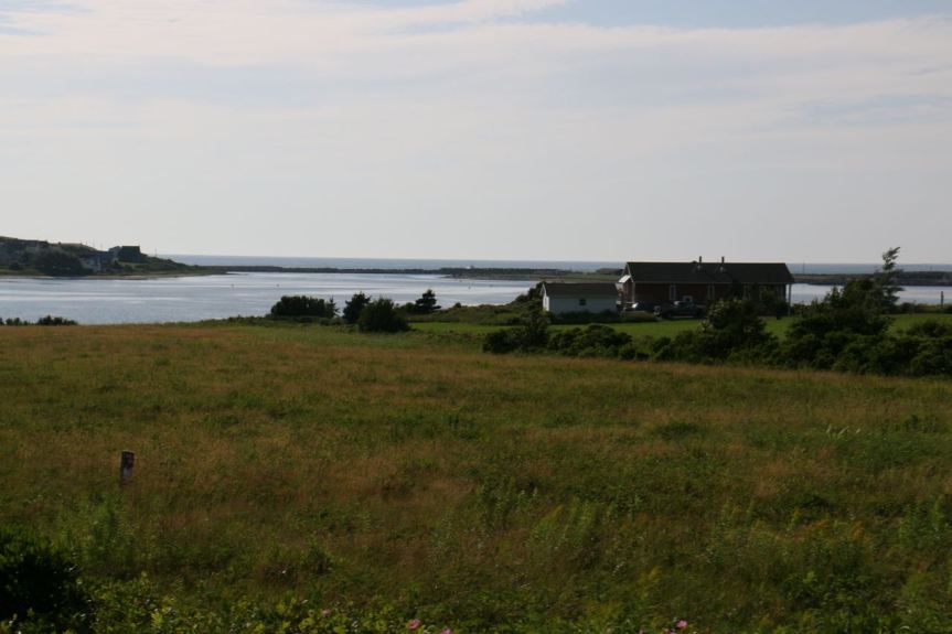
The first campground in Presque Isle, Maine – Arndt’s Aroostook River Lodge, was such a nice surprise. Big sites and such nice people. The majority of the campers stayed there for the season so us coming in for four days was a bit unusual. One of the best parks for tent camping, nice secluded sites far removed from the RV’s with plenty of trails.
They tap their maple trees, over a thousand on their property, and use this huge machine pictured below to evaporate the liquid and make the syrup. They said it takes 40 gallons of sap to make approximately a gallon of syrup. This machine is about 3 feet wide and 10 feet long; the three pipes are vented through the roof. Of course, we had to buy some Maine Gold Syrup. It was and is delicious!
Hiking one of the many trails with such a variety of hardwood trees, loved seeing all the birch with the peeling bark!What a happy dog!
What a treat this province was, I would love to spend summers here! Definitely old world charm, incredible warm and friendly people and such beautiful scenery! I feel like I just barely got to explore this area!
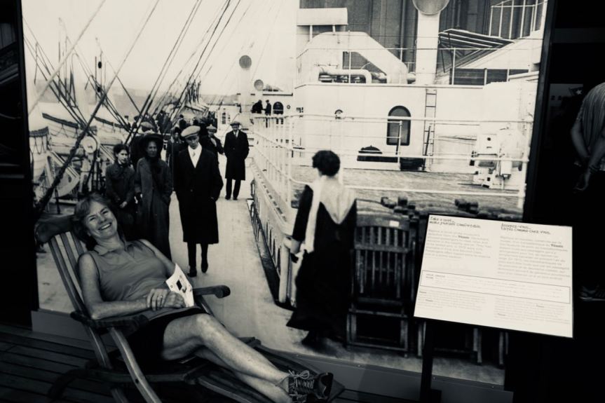
A bit cheesy but visited the Maritime Museum in Halifax and couldn’t resist not becoming part of the Titanic exhibit.
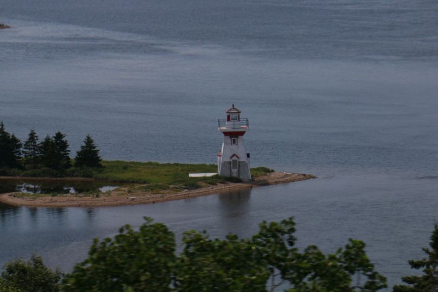
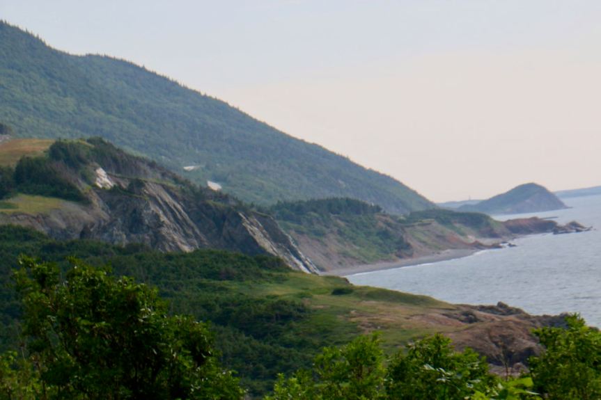
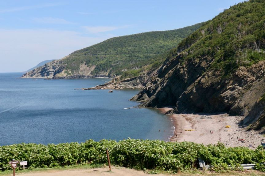
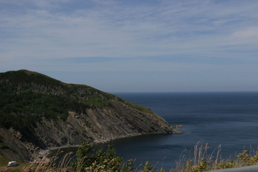
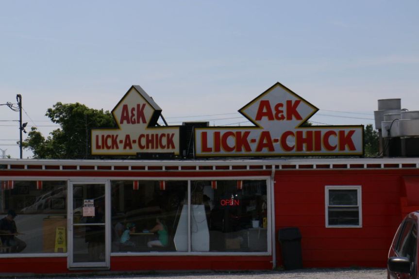
One of my favorite lighthouse photos, on the way to Sydney, NSBeautiful scenery, wonderful during the summer, not so sure about the winter.Along the Cabot Trail on Cape BretonAlong the Cabot Trail on Cape Breton, NS, Meat Cove, the most northern point on the Cape.Breathtaking views everywhere you look!We wished we could have seen a whale! Still was so beautiful.Just barely got the sunset…..Couldn’t resist sharing the popular fast food of Cape Breton – think this restaurant would make it in the USA?
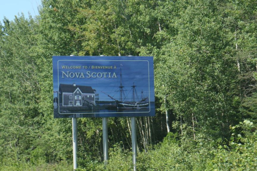
We traveled through New Brunswick across the Confederation Bridge, a curved 8 mile long bridge, the longest in the world crossing ice-covered water which was just completed in 1997, to reach Prince Edward Island.(PEI) Prince Edward Island is located off the eastern coast of Canada, between the provinces of New Brunswick, Nova Scotia, Québec and Newfoundland and Labrador in the Gulf of St. Lawrence.
8 miles long
As we drove towards PEI National Park, I couldn’t get over how lush the island was and how beautiful. We bought local potatoes, which were so creamy and beets that were incredibly fresh. Almost as good as the seafood! The beaches are so numerous and each so different, I don’t think I’ve ever seen sandstone beaches before. What a treat to have such beautiful beaches and minimal houses.
Early morning on the beach!Cavandish BeachPerfect weather, location and company!Taking a break on our bike ride as we check out the beachLong, empty beaches to explore Sandstone beachesSpent one day riding on the island, smooth level trails!Beautiful sunset from the campground at PEI National Park.
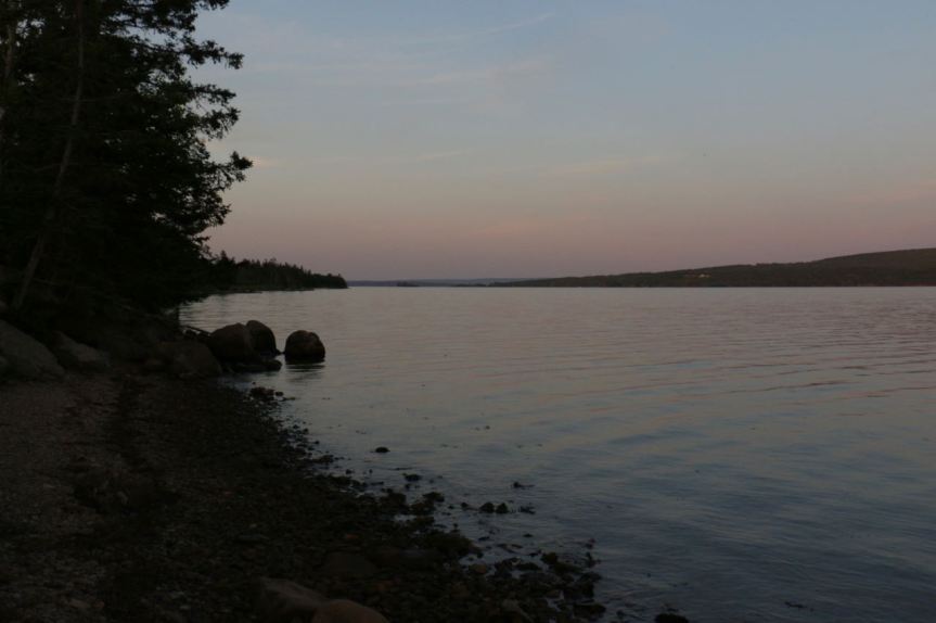
One of the places we wanted to visit in Canada was the Bay of Fundy, located halfway between the equator and the north-pole separating New Brunswick and Nova Scotia. The first morning we were there I managed to get up early enough to see a glorious sunrise.
Twice each day, 160 billion tons of seawater flows in and out of the Bay of Fundy — more than the combined flow of the world’s freshwater rivers! The Bay of Fundy’s tides transform the shorelines, tidal flats and exposed sea bottom as they flood into the bay and its harbors and estuaries.
Amazing difference between high and low tides.
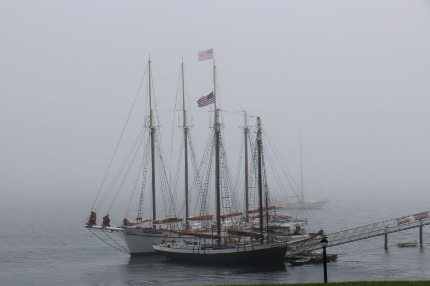
The tide needs to rise high enough for the boats to be level with the docks.
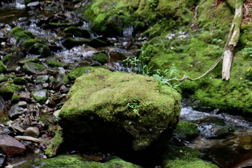
The forests are so lush, which also means it is incredibly humid, so much different than Colorado. The moss is thick enough to support growth on the rock.
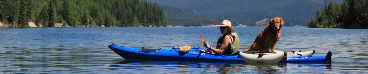
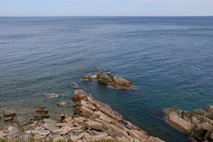
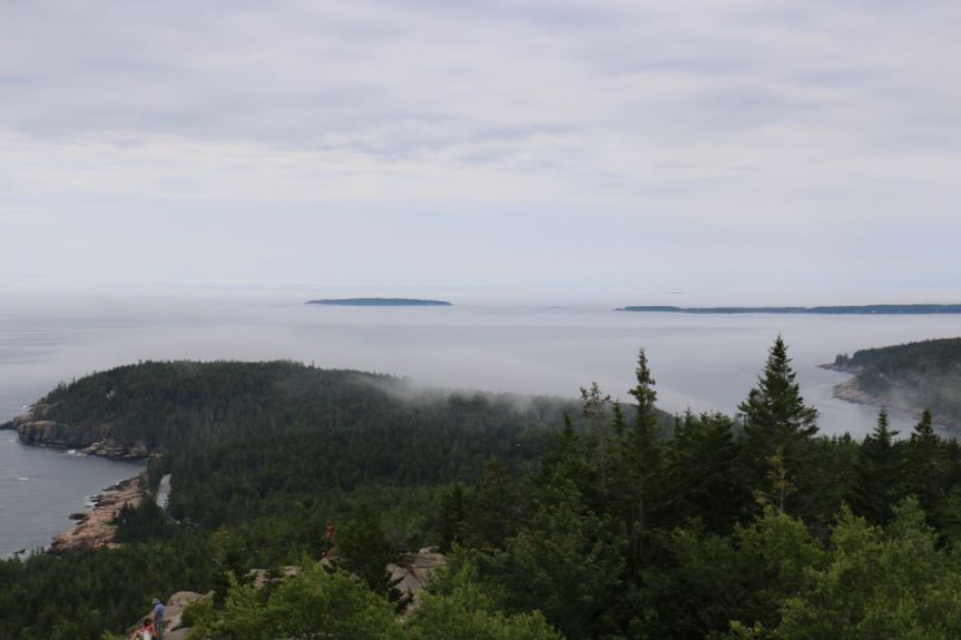
What a beautiful state. We hiked Gorham Peak, 525 feet, right on the coast with gorgeous views. We could summit many peaks here compared to Colorado! Hiking the coast, enjoying the vistas and even kayaking a bit!
Quite the Peak!
I’m sure I could do more than one peak in a day here!
Beautiful coastal hiking!
Loving the sounds of the surf but even better not getting wet!
So relaxing!
Of course, our selfie!
Took one of my favorite photos of the trip, suitable for framing don’t you think? It is just amazing how the fog rolls in – you see it coming, feel the moisture as it moves over you and then it’s gone, at least that is how we experienced it on this day.
Memories of our Windjammer Cruise in March. Yes, the year continues to be marvelous!